
Old Maps
Ladak East
with parts of Balti and Monyul
by H. Strachey
1851
Source: pahar.in
Nari Khorsum
by H. Strachey
1851
Source: pahar.in
Demchok
by H. Strachey
(details)
1851
Source: pahar.in
Ladak
by H. Strachey
1851
West Nari and Indian Himalaya
by H. Strachey
1854
Source: pahar.in
Western Tibet
by Rawling and Deasy
1905
Source: pahar.in
Western Tibet
by Rawling and Hargreaves
1905
Source: pahar.in
Chinese Turkistan and Gansu
Sheet 9
by Aurel Stein
1919
Source: pahar.in
Chinese Turkistan and Gansu
Sheet 10
by Aurel Stein
1919
Source: pahar.in
Western Sector according to China
1960
Line of Actual Control
in Demchok Sector
(according to China)
Ladakh
The Empire of King Tsewang Namgyal and King Jamyang Namgyal (1560/1600 A.D.)
US Joint Operations Maps
Pangong Tso 1963
Ref: NI-44
1963
Source: US Army Service Map
Shyok Drokpo Karpo
Ref: NI-44-5
1967
Source: US Army Service Map
Border Tibet-Ladakh
Ref: NI-44-10
1973
Source: US Army Service Map
NI-44-13 Tso Moriri 1
Ref: NI-44-13
1982
Source: US Army Service Map
Dumchule area
Ref: NI-44-9
1982
Source: US Army Service Map
Aksai Chin
Ref: NI-44-1
1982
Source: US Army Service Map
Chushul
Ref: NI-44-9
Source: US Army Service Map
1982
Hotan
Ref: NJ-44-3
Source: US Army Service Map
1982
Ladakh
Ref: TPC-G-70
1995
Source: US Army Service Map
Western Tibet
Ref: NI-44
1941
Source: US Army Service Map
Pangong Tso
Ref: NI-44
1950
Source: US Army Service Map
Leh
Ref: NI-43-8
1954
Source: US Army Service Map
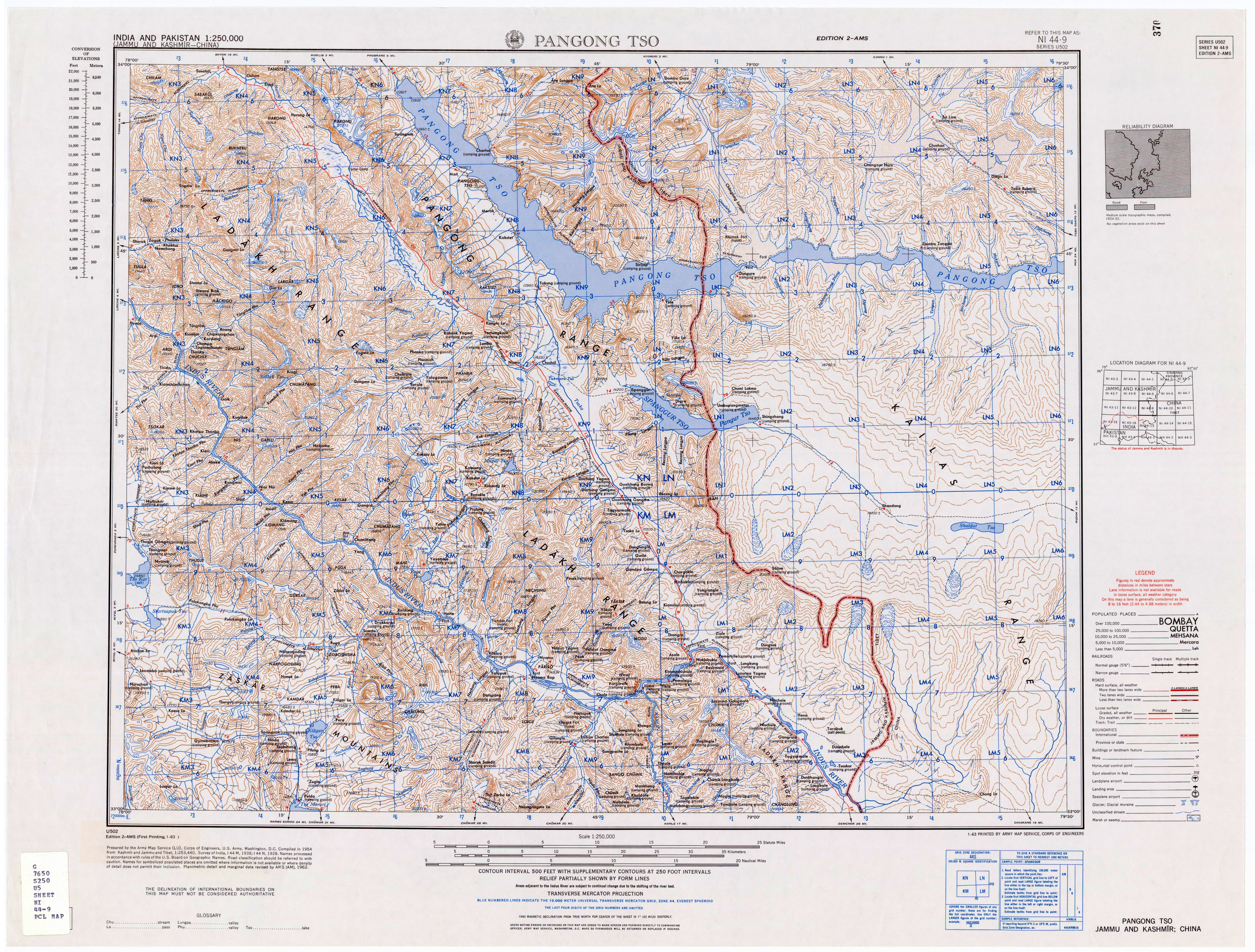
Pangong Tso
Ref: NI-44-9
1954
Source: US Army Service Map
Tso Morari
Ref: NI-44-13
1954
Source: US Army Service Map
Tsomoriri Kinnaur
Ref: NI-44-13
1954
Source: US Army Service Map
Shyok
Ref: NI-44-5
1955
Source: US Army Service Map
Aksai Chin (Ladakh)
Ref: NI-44-1
US Joint Operations Graphic 1:250,000 U.S. National Imagery and Mapping Agency
Chushul Dumchele
Ref: NI-44-9
US Joint Operations Graphic 1:250,000 U.S. National Imagery and Mapping Agency
Tso Moriri
Ref: NI-44-13
US Joint Operations Graphic 1:250,000 U.S. National Imagery and Mapping Agency
Aksai Chin
Ref: NI-44-14
US Joint Operations Graphic 1:250,000 U.S. National Imagery and Mapping Agency
Government of India Maps
Aksai Chin
1956 Chinese Claim Line
1963
Source: Government of India
Aksai Chin
1959 Chinese Claim Line
1963
Source: Government of India
Chinese Aggression
1963
Source: Government of India
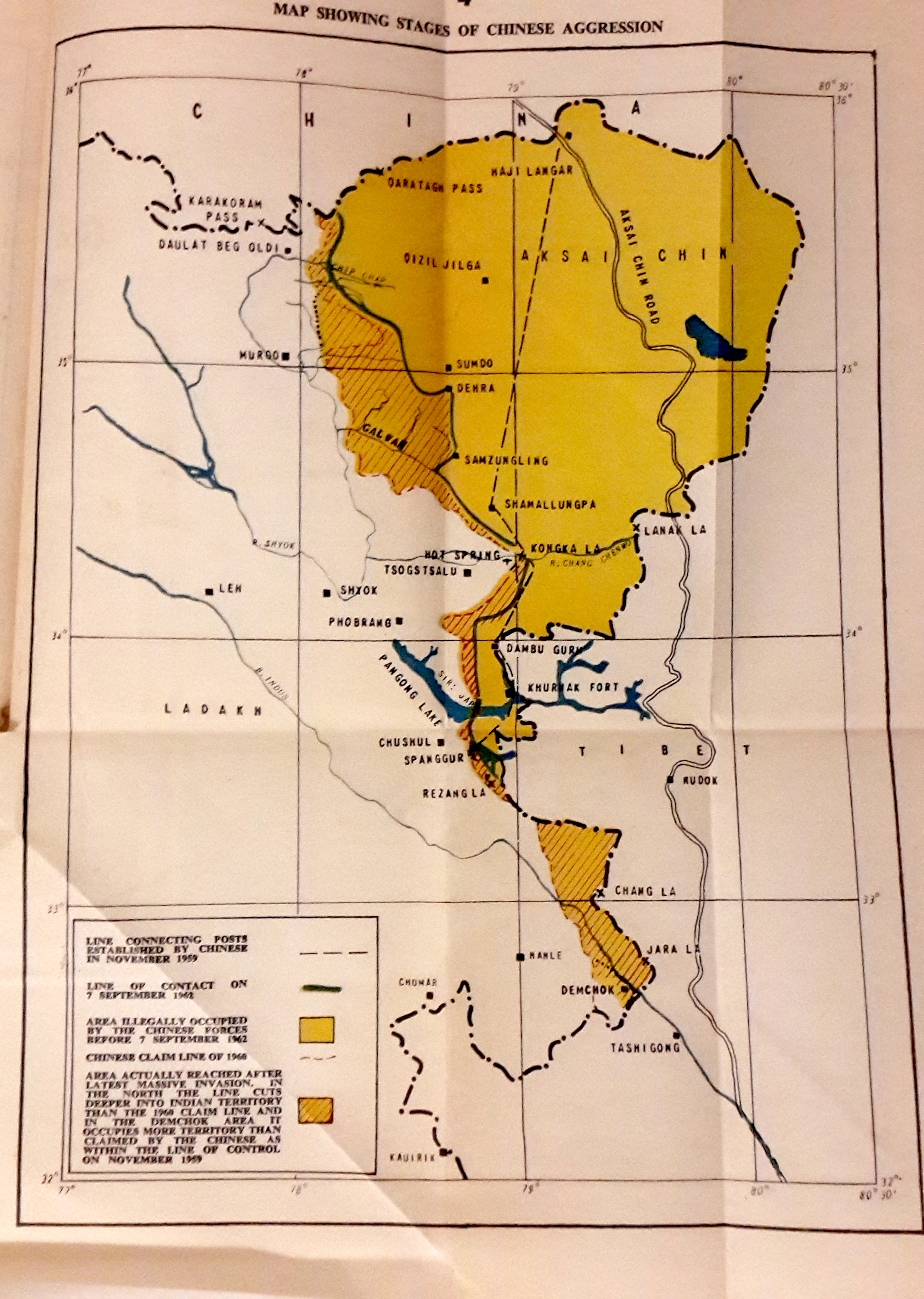
Survey of India pre-Independence maps (from the Library of Congress)
Lower Chang Chenmo
Ref: 52 J
1875
Source: Survey of India
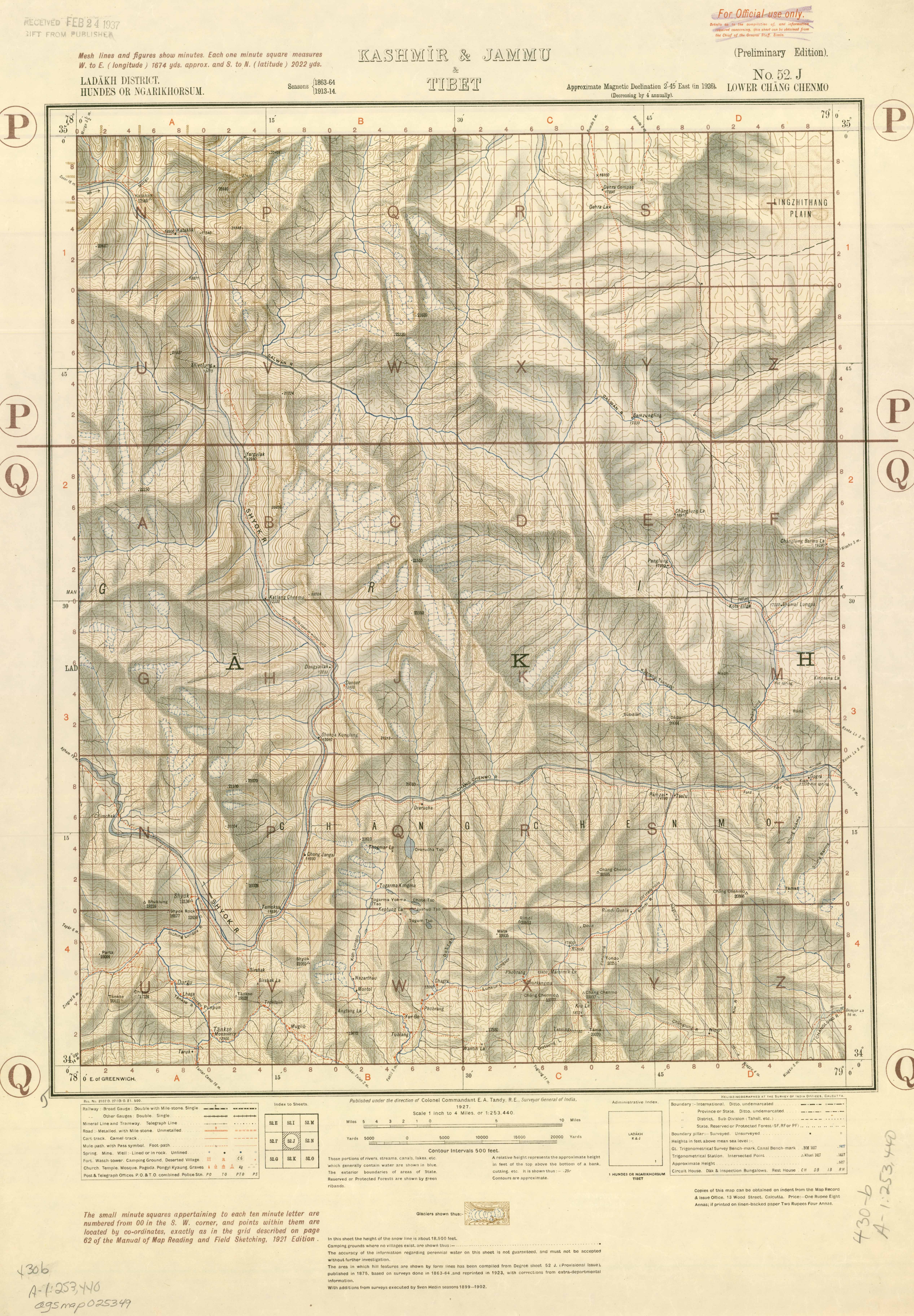
Lower Chang Chenmo
Ref: 52 J (preliminary)
1927
Source: Survey of India
Map of Ladakh
Routes in the Western Himalaya, Kashmir, &C.
by Major Kenneth Mason, M.C., R.E.,
Source: Survey of India
1929
Map of Kashmir
Routes in the Western Himalaya, Kashmir, &C.
by Major Kenneth Mason, M.C., R.E.,
Source: Survey of India
1929
Kara-Tagh Pass
Ref: 52 I
Source: Survey of India
1928
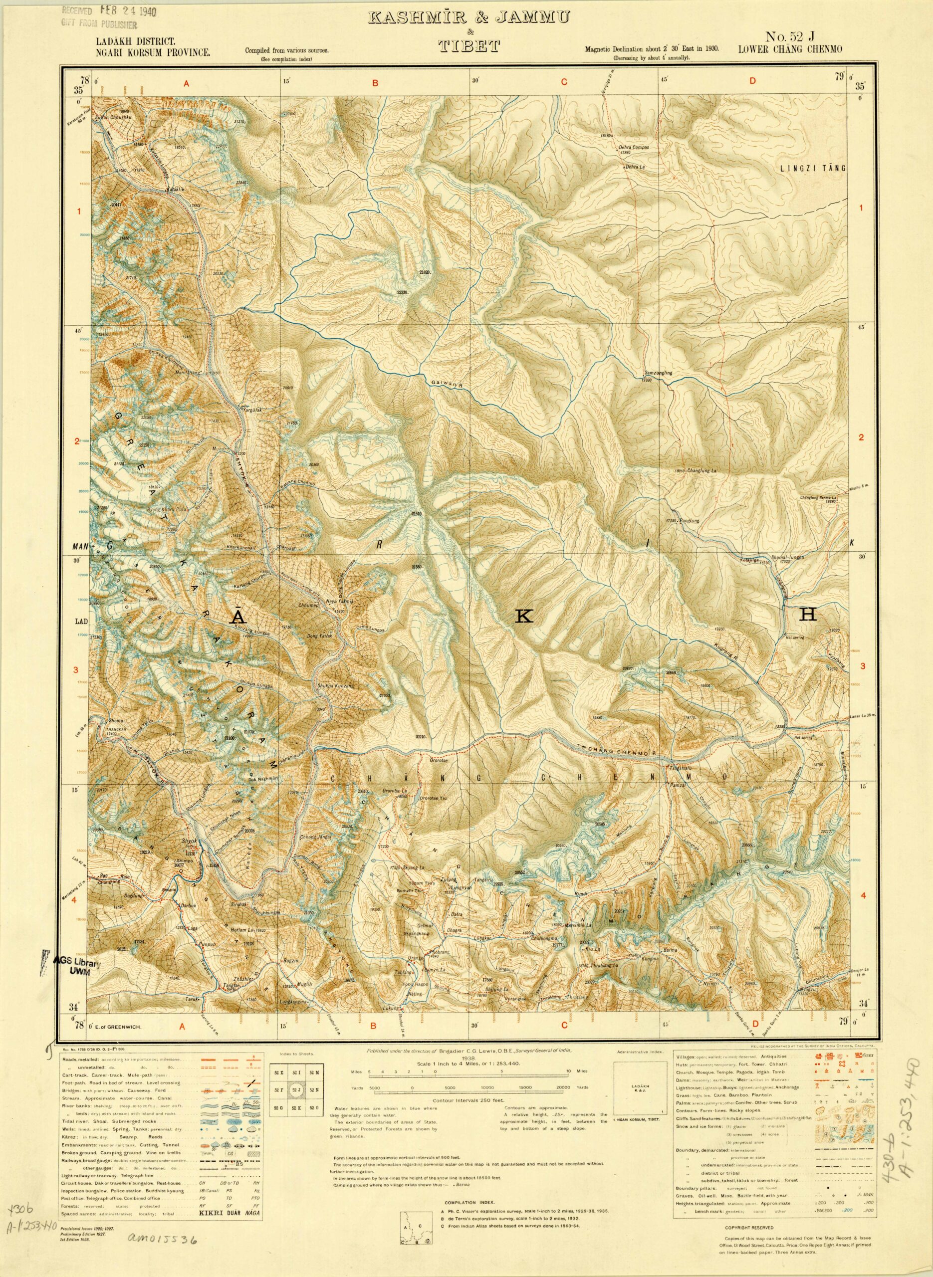
Lower Chang Chenmo
Ref: 52 J
1938
Source: Survey of India
Pangong Tso
Ref: 52 K
1938
Source: Survey of India
Tso Morari
Ref: 52 L
1928
Source: Survey of India
Lanak-la (Ladakh)
Ref: 52 N & M
1875
Source: Survey of India
Aksai Chin
Ref: 52 M
1928
Source: Survey of India
Lanak La
Ref: 52 N
1928
Source: Survey of India
Rudok
Ref: 52 O
1874
Source: Survey of India
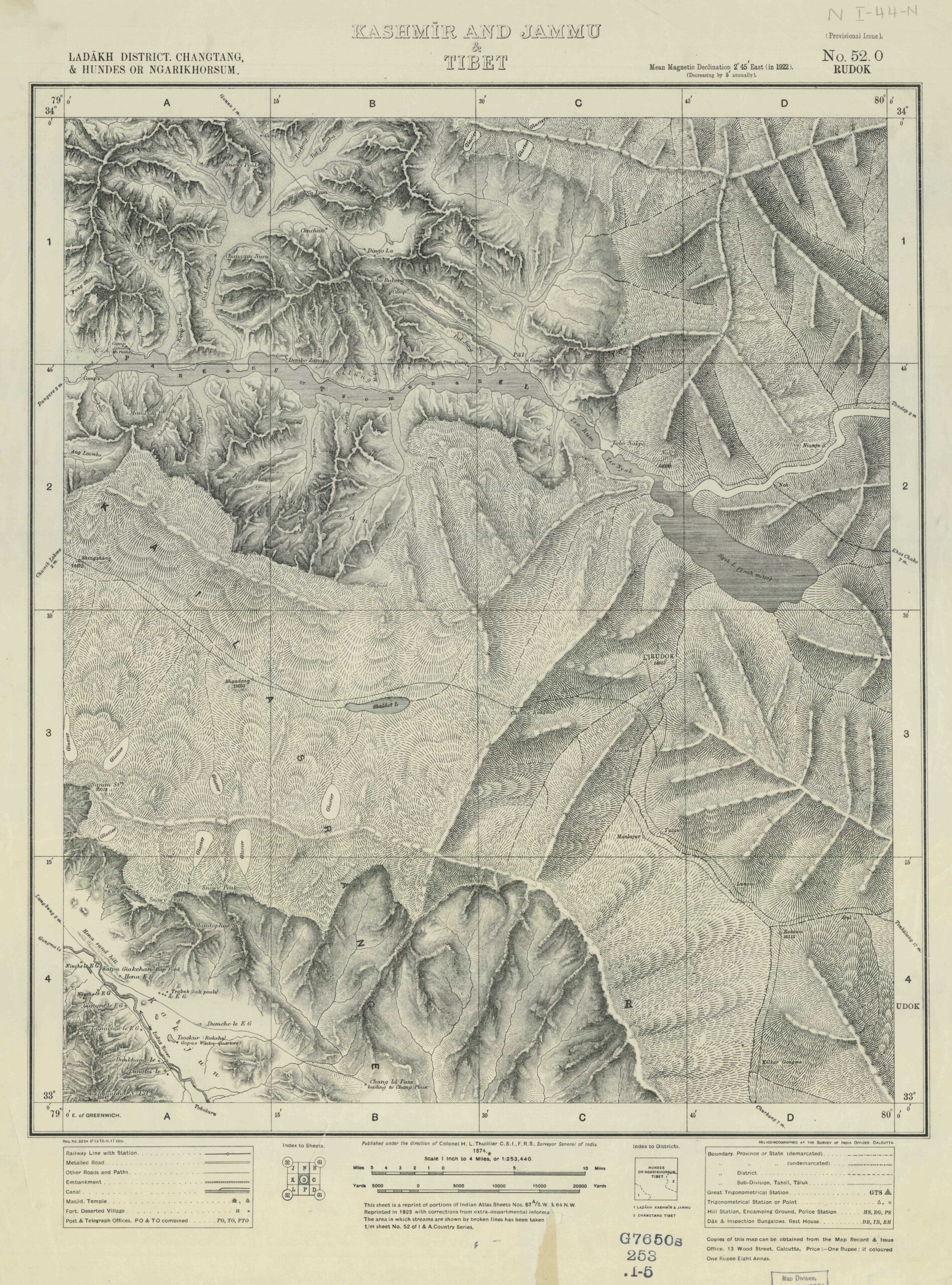
Rudok
Ref: 52 O
1950
Source: Survey of India
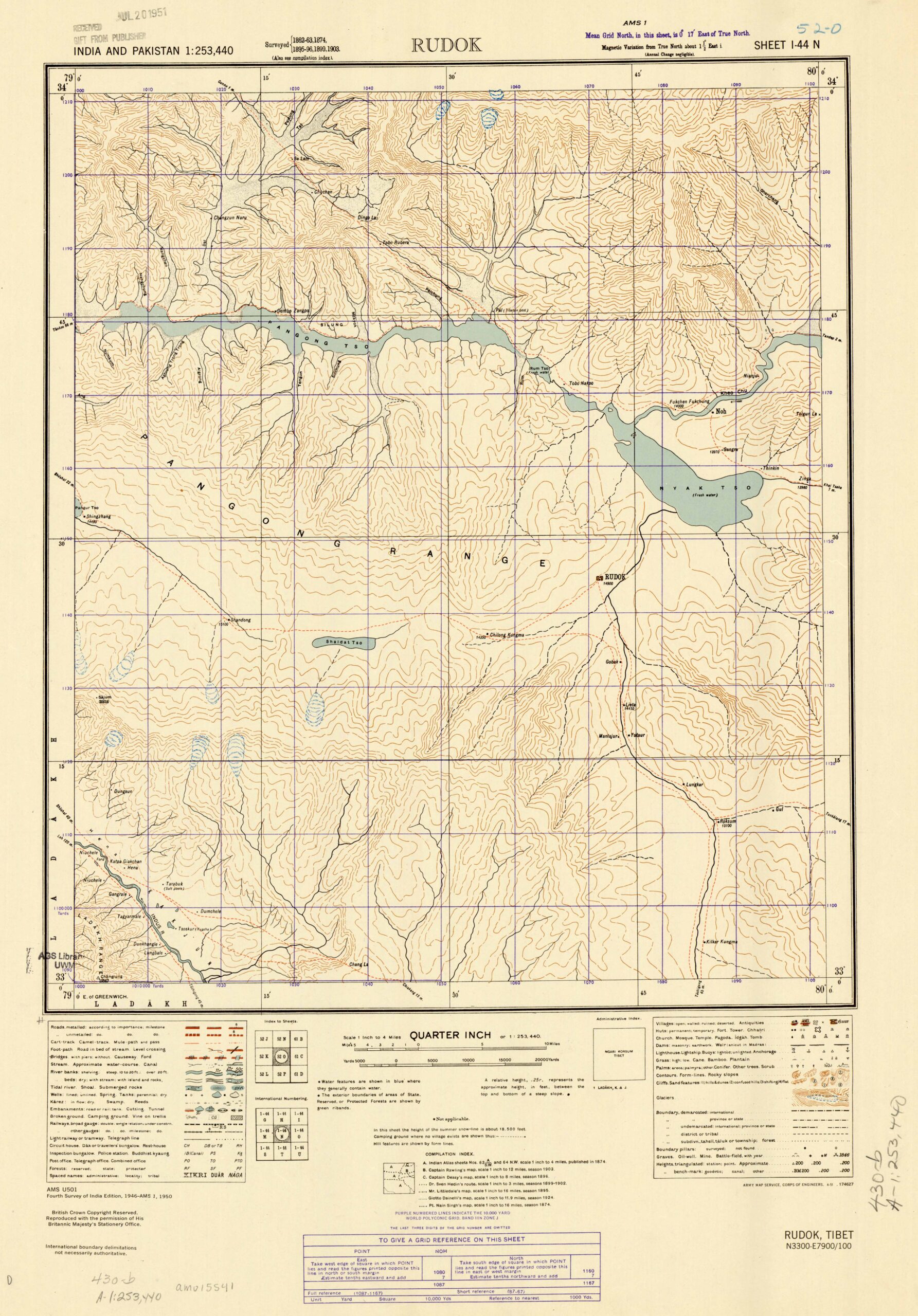
Tashigong
Ref: 52 P
1928
Source: Survey of India
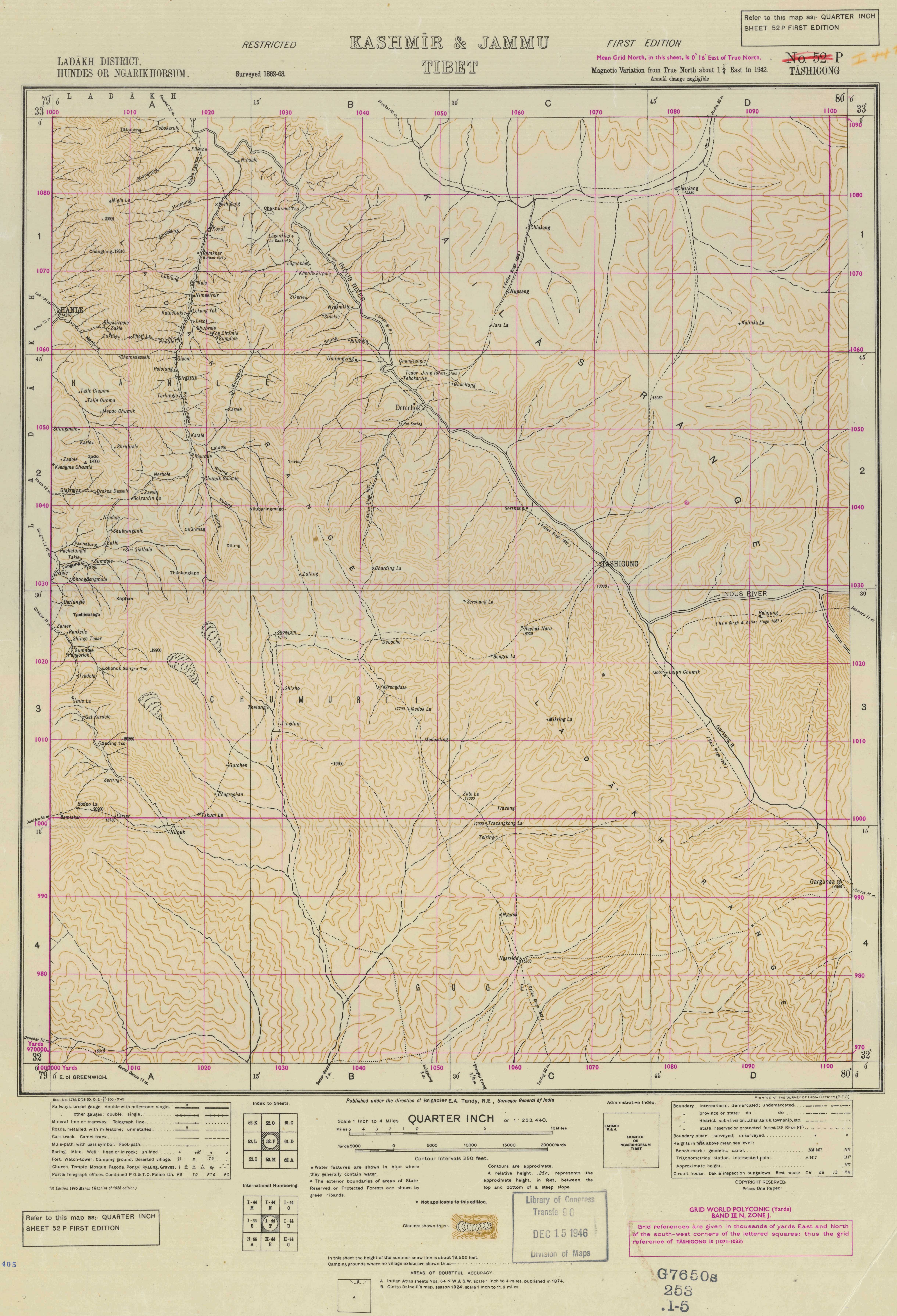
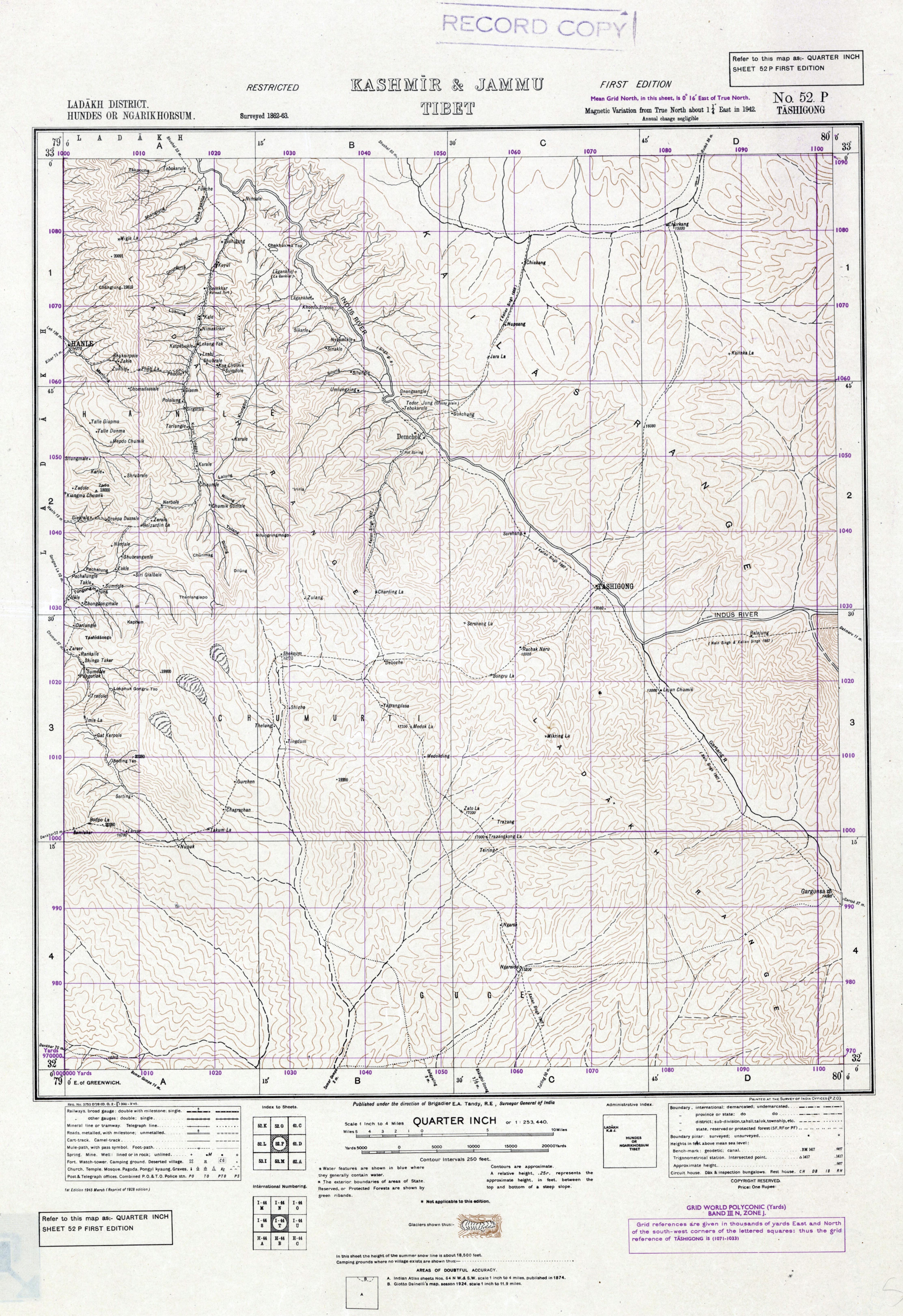
Tashigong
Ref: 52 P
1945
Source: Survey of India
Tashigong
Ref: 52 P
1945
Source: Survey of India
My Maps
The Aksai Chin road
Map of the Aksai Chin road cutting across Eastern Ladakh